Deforestation in Brazil up 22% last year

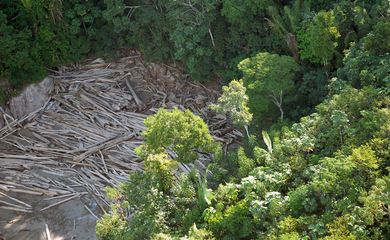
Last year, Brazil’s total deforested area expanded 22.3 percent from 2021, up 2.05 million hectares, as per the Relatório Anual de Desmatamento (“Annual Deforestation Report”) by MapBiomas, an association of institutions including universities, NGOs, and technology companies.

From 2019 to 2022, when the survey was in progress, 303 thousand deforestation events were reported across 6.6 million hectares. Agriculture and cattle raising were the main driver behind deforestation in the country, with 95.7 percent of the total, or 1.96 million hectares. Small-scale mining (known as garimpo) accounts for 5.9 thousand hectares, with large-scale mining at 1.1 thousand hectares.
Figures
In five of the six Brazilian biomes, a growth was observed in the deforested area: the Amazon, the caatinga, the cerrado, the pampa, and the pantanal. The exception was the Atlantic forest. Considering the affected area, the largest increments took place in the Amazon (190,433 hectares) and the cerrado (156,871). Proportionally, the cerrado (31.2%) and the pampa (27.2%) were the most severely impacted.
As for vegetation types and land use, a predominance of deforestation was found in forest formation (64.9%), savanna formation (31.3%), and grassland formation (3.6%).
State by state, Pará leads the deforestation ranking with 22.2 percent of the entire country’s area (456,702 hectares). Next come Amazonas, with 13.33 percent (274,184); Mato Grosso, with 11.62 percent of the deforested area (239,144); Bahia, with 10.94 percent (225,151); and Maranhão, with 8.2 percent (168,446). The five states account for 66 percent of deforestation in Brazil.
Traditional territories
Traditional quilombola and indigenous territories boast the country’s best preservation rates. Deforestation in indigenous lands corresponds to 1.4 percent of the total area deforested in Brazil (26,598 hectares) and 4.5 percent of the total number of alerts. Most alerts (91%) were issued in the Amazon biome. The largest area deforested is located in the Apyterewa territory, in Pará, with 10,525 hectares affected.
In quilombola communities, originally founded by people fleeing slavery, deforestation corresponds to 0.05 percent of the total area in the country. Of 456 certified communities, 62 (26.1%) had at least one alert issued, with at least 0.3 hectares affected. The community with the largest deforested area was Kalunga, in Goiás, with 258 hectares of vegetation suppressed, part of it inside the Pouso Alto Environmental Protection Area, in the surroundings of the Chapada dos Veadeiros National Park.
Impunity
The report casts light on the action taken by environmental watchdogs to curb illegal deforestation, like fines and embargoes. The initiatives undertaken until May this year reached only 2.4 percent of the deforestation alerts and 10.2 percent of the area deforested from 2019 to 2022.
In this period, the states with the most efforts by agencies and prosecution services to tackle deforestation alerts stemmed from Espírito Santo (73.7 percent of the events in the state), Rio Grande do Sul (55.6%), São Paulo (40.3%), and Mato Grosso (37.3%).
The states with the lowest number of initiatives were Pernambuco (0.8%), Maranhão (1.6%), and Ceará (1.9%).


